

 Shop For Art
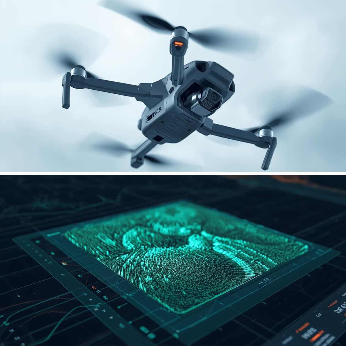

“Exactly what I needed. Great condition, fast delivery, and super easy to return. I’ll definitely be hiring from HireLoad again!”

“I wasn’t sure what to expect, but everything was spot on. The equipment was in excellent condition and the customer support was top-notch.”

...ed on time, easy to assemble, and super sturdy. Made my job a lot easier.”
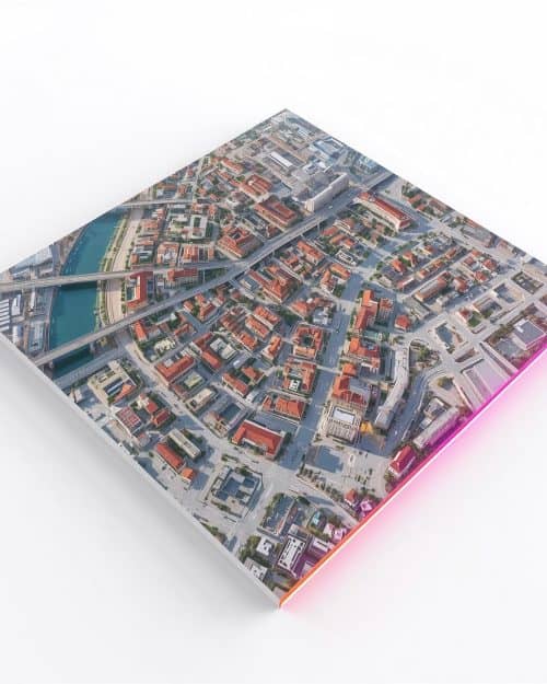
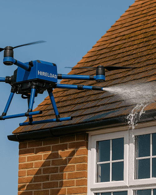
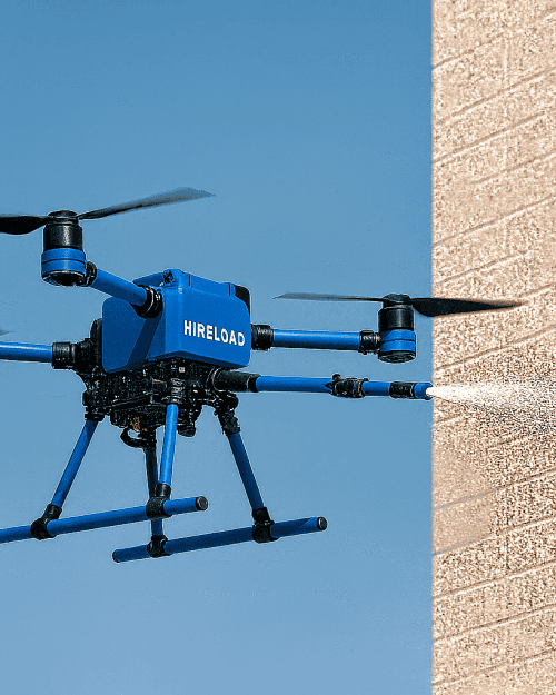
Professional Drone Surveying & Mapping Services in London | Accurate Aerial Data by Hireload
Professional Drone Surveying & Mapping Services in London | Accurate Aerial Data by Hireload
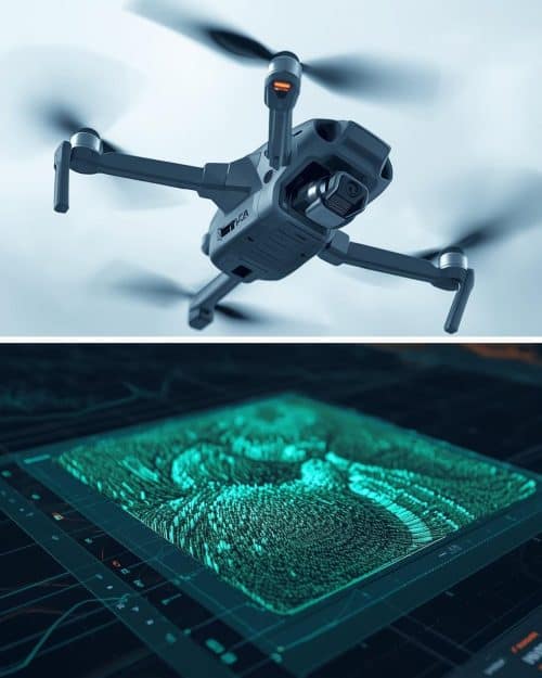
Drone Surveying & Mapping
$186.00

Description
Drone Surveying & Mapping Services (Commercial & Construction Projects)
Revolutionising Surveying with Drones
At Hireload, we provide next-generation drone surveying & mapping services designed for speed, accuracy, and safety. Our drones capture high-resolution aerial data that enables detailed topographic maps, 3D models, and volumetric analyses — all without the need for manual site visits or heavy ground equipment.
Whether you manage a construction site, infrastructure project, or land development, our drone mapping technology gives you reliable data faster and more efficiently than traditional surveying methods.
Why Choose Drone Surveying & Mapping?
Traditional land surveying can be time-consuming and labour-intensive. Drones transform that process by capturing hundreds of data points in minutes, generating measurable and georeferenced maps that are accurate within centimetres.
Key Advantages:
-
High Accuracy: Using RTK (Real-Time Kinematic) GPS technology, our drones deliver mapping precision up to ±2 cm.
-
Cost Efficiency: Reduce manual surveying costs by 50–70%.
-
Safety First: Zero need for surveyors to access hazardous or unstable terrain.
-
Speed: A full construction site survey can be completed within hours.
-
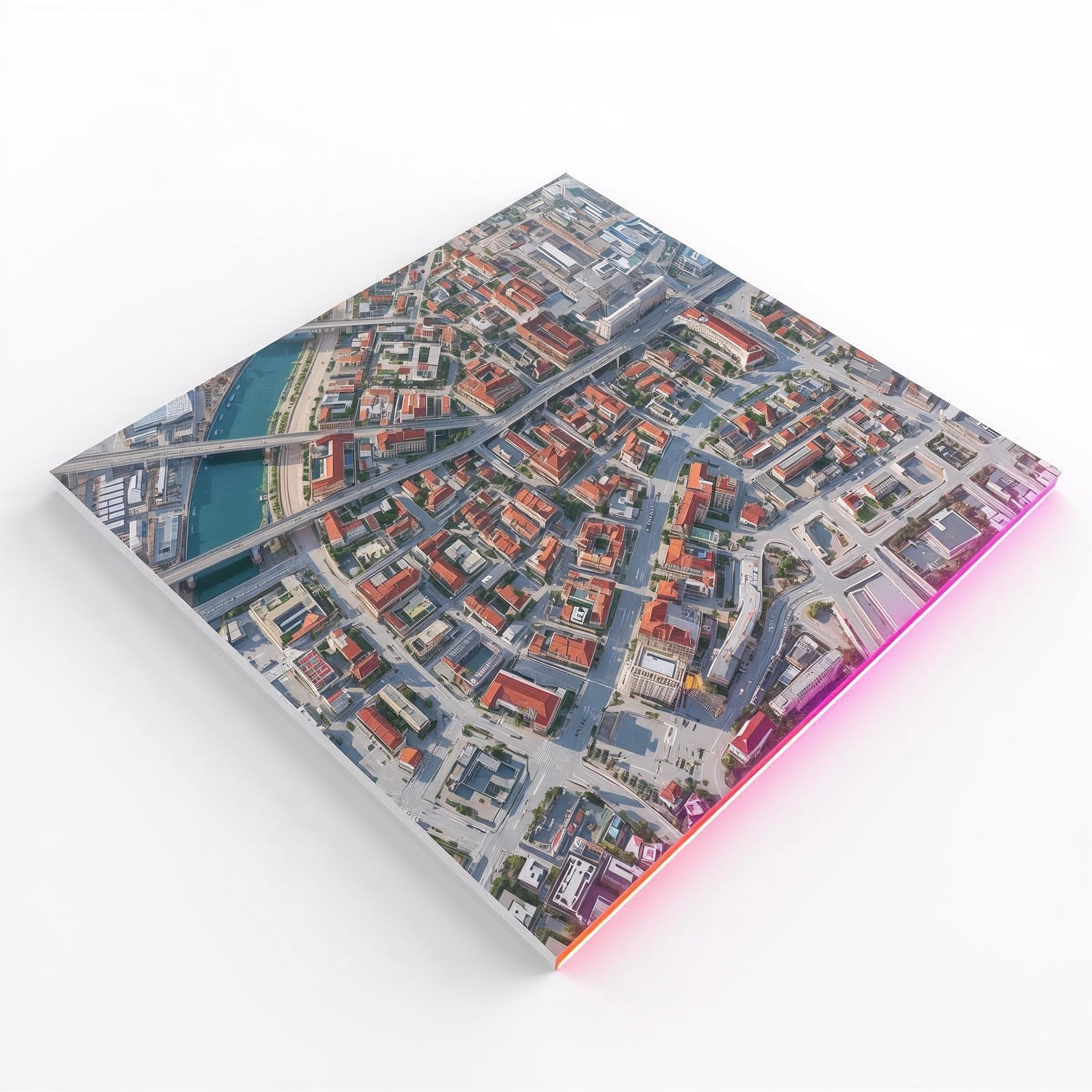
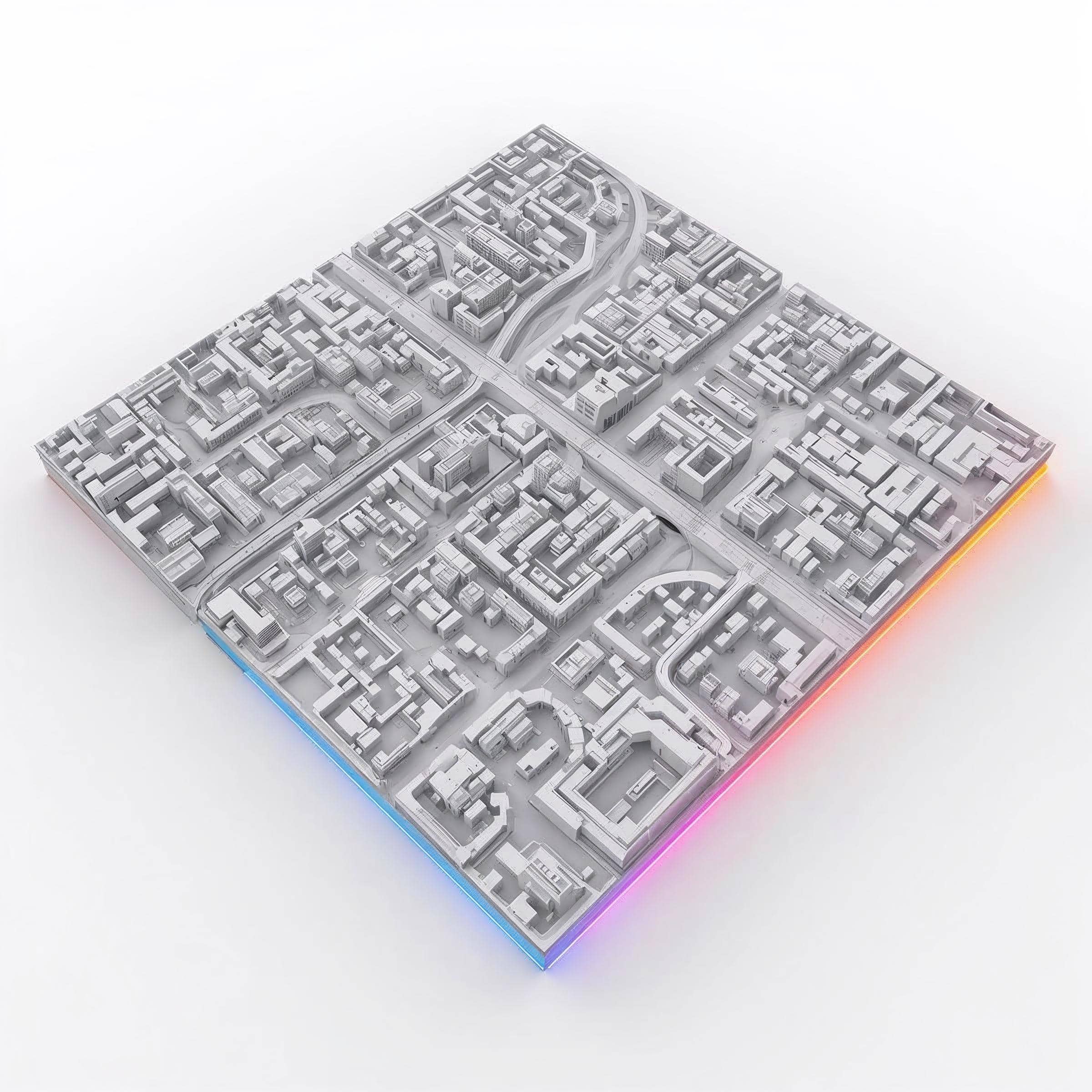
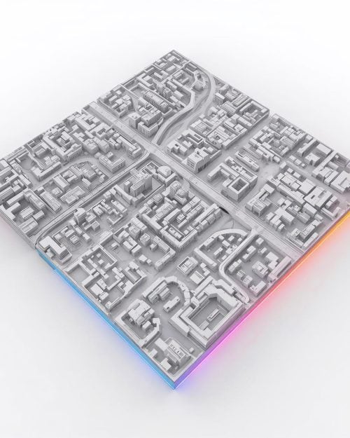
Data Versatility: Get outputs in orthomosaic maps, point clouds, DSM/DTM, and 3D mesh formats.
Applications of Drone Surveying
Our drone surveying and mapping services are trusted across multiple industries:
-
Construction: Monitor progress, measure stockpiles, and verify as-built accuracy.
-
Real Estate Development: Capture elevation data and visual assets for planning.
-
Infrastructure: Survey roads, bridges, and utilities efficiently.
-
Agriculture: Create NDVI maps to monitor crop health and yield.
-
Environmental Studies: Conduct terrain and vegetation analysis for conservation planning.
Every project benefits from real-time insights and deliverables that integrate seamlessly with GIS, CAD, and BIM software environments.
Technology & Equipment
Hireload operates advanced UAV systems such as the DJI Matrice 350 RTK .These drones allow for:
-
Sub-centimetre positional accuracy
-
3D terrain reconstruction
-
Cloud-based data processing
-
Compatibility with Autodesk Civil 3D, ArcGIS, and Pix4D
All flights are conducted by CAA GVC-certified pilots, ensuring full compliance with UK aviation regulations.
Our Process
-
Pre-Survey Planning: We assess airspace restrictions, project scope, and weather conditions.
-
Flight Execution: Drones fly automated grid missions capturing geotagged imagery.
-
Data Processing: Collected data is transformed into detailed topographic or volumetric maps.
-
Quality Control: Our engineers verify data accuracy before delivery.
-
Delivery: Final reports and 3D models are shared via secure cloud access.
Case Study: Construction Site Survey, East London
A civil engineering firm required a detailed site survey for a new development covering 5 hectares. Traditional methods estimated a 3-day timeline. Using Hireload’s drone surveying & mapping, the job was completed in under 4 hours with 98% accuracy, producing 3D surface models, contour lines, and volumetric cut-fill data for earthworks management.
Result:
✅ 70% time savings
✅ 50% cost reduction
✅ Improved decision-making within 24 hours
Frequently Asked Questions (FAQ)
Q1: How accurate are your drone surveys?
Our RTK drones achieve positional accuracy within 2–3 cm horizontally and vertically.
Q2: Can drone mapping replace traditional surveying?
For large-scale or difficult-to-access sites, yes — drones complement or even replace traditional methods depending on project requirements.
Q3: What file formats do you provide?
Orthomosaics (GeoTIFF), 3D point clouds (LAS), CAD files (DXF), and PDF reports.
Q4: Do you offer recurring surveys for progress tracking?
Yes, we provide scheduled drone surveys weekly or monthly for construction monitoring.
Q5: Is drone surveying weather-dependent?
Surveys are paused in high wind or rain to ensure safety and data accuracy.
Why Hireload?
-
Fully licensed drone operators (CAA GVC & A2 CofC certified)
-
UK coverage with dedicated support in London and Home Counties
-
Enterprise-grade drones and cloud processing
-
Competitive pricing and transparent reports
-
Integration with other drone services (e.g., Cladding Cleaning, Roof Inspection)
Book a Drone Survey Today
Gain instant access to precision aerial data.
📍 Contact our specialists to book your drone surveying & mapping service or request a tailored quotation.
👉 Book Now
Additional information
| 4 Storey House | 1 |
|---|
Reviews (0)
Reviews
There are no reviews yet.
Be the first to review “Professional Drone Surveying & Mapping Services in London | Accurate Aerial Data by Hireload”
Fully Maintained & Safe Equipment
Clear, upfront pricing – no hidden fees
Flexible Hire Durations
Easy & Fast Booking
Same-day Delivery
How to Hang Our 5 Panel High Def Canvas Wall Art
Buy it. Receive it, Enjoy !!
Frequently Asked Questions (FAQ)
I just placed an order, when will i receive it?
7 - 10 days.
Our prints will be created, dried, pressed, framed, and shipped within five Business days from the time they are ordered. To maintain quality, they are created as they are purchased. Tracking numbers will be provided six or seven business days after the order is placed.
If you still have questions, you can contact us anytime.
Email: info@sportsartdirect.com
I placed an order, but have not received any email from you with details about the order. When will I receive that?
All order detail emails are sent out as soon as you complete your order. If you can't find it, please check your spam mail box as it might have landed in there. If you still can't find it, please make sure that you have entered your email address correctly when you ordered.
It Says My Address Is Not Found
A: If you have a PO box and do not get mail at your physical address, you should use the PO box. The verification can be tricky on specific abbreviations as well. It is best to use the “find zip code” or "zip code lookup" on your local post office website to help find your specific abbreviations and how to verify your address. Depending on your country, your package will be shipped by either USPS, Canada Post, FedEx, Australia Post, etc..
You Made A Mistake On My Order.
e are very sorry. It doesn’t happen often, but nobody’s perfect. Email us and we’ll work with you to make it right.
I ordered 2+ items, but only received one... where's my order?
We have a large assortment of products not stocked in house, when you order multiple items at a time, they may be shipped separately so they get to you faster. You may receive one item before the next. So don't panic if you don't receive all of your items at once, they are on the way.
Check the Hireload FAQ for guidelines on extensions.
Can I Get a Refund?
Orders must be canceled within 24 hours of when you placed your order. Otherwise, the item must be returned in order to provide a full refund.
I have a question that wasn't answered, can you please help?
We are here to help you make your space beautiful! Please contact us and we will be happy to assist you in any way we can. Please attach your order number and address the problem clearly when contacting us.
Please note that it usually takes six or seven days for orders to be completed and make it onto the shipping truck to you.
Email Address - info@sportsartdirect.com

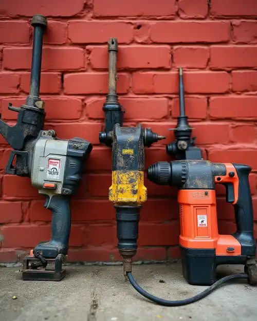
Top Picks for Hire
Access Equipment
$298.80
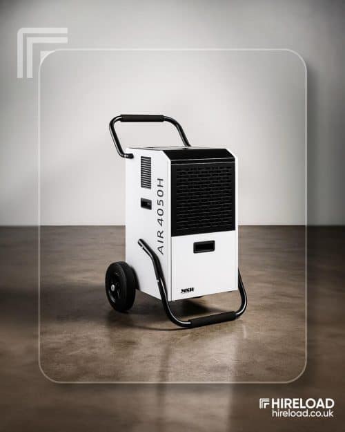
Cooling & Heating
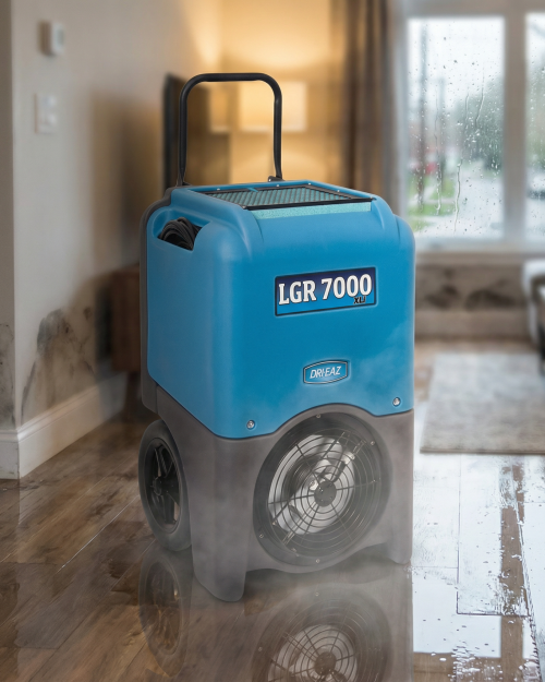
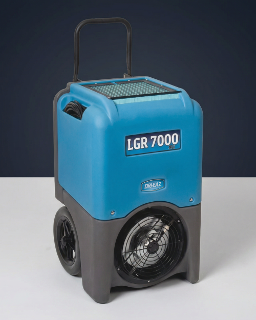
Heavy-Duty Industrial Dehumidifier 110V (Building Dryer, 70–90 L)
$83.99
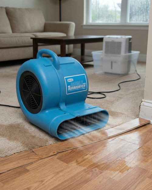
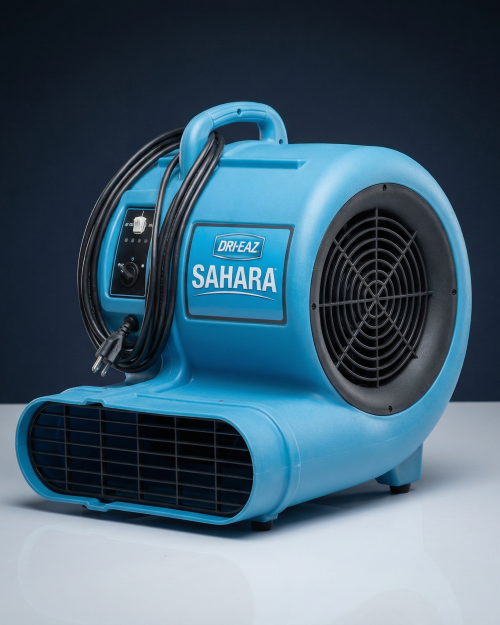
Carpet & Floor Dryers
$41.39
General Site Tools
$83.99
Testimonials
“I wasn’t sure what to expect, but everything was spot on. The equipment was in excellent condition and the customer support was top-notch.”
“Brilliant service from start to finish. The tower arrived on time, easy to assemble, and super sturdy. Made my job a lot easier.”

“Easy to book, affordable price, and no hidden charges. I used it for a home project and it worked perfectly. Highly recommend!”
“Honestly one of the smoothest hire experiences I’ve had. Great kit, arrived clean and ready to use. Will be using HireLoad again for sure.”


Related products
Commercial Roof Cleaning
Drone Commercial Roof Cleaning | Fast, Safe & Sustainable Solutions
$78.00

$38.40
Commercial Window Cleaning
Professional Drone Window Cleaning (Commercial & Residential) Drone Window Wash
$186.00

Reviews
There are no reviews yet.